
Is there a website or resource that overlays the position of disused and built over airfields over the current landscape? I'm particularly interested in West Malling/Kings Hill.
Thanks
Did you know that registration to Fighter Control is completely free and brings you lots of added features? Find out more....
Then & Now maps
Then & Now maps
In this world there's two kinds of people, my friend. Those with loaded guns, and those who dig. You dig.
-
Freeman Lowell

- Posts: 1301
- Joined: Thu Oct 08, 2009 8:00 pm
- Location: Blandford Forum, occasionally
Re: Then & Now maps
Sparts,
For that particular airfield, GE gives 1940, 1960, 1990, 2003 images and onwards to the present day.
Freeman
For that particular airfield, GE gives 1940, 1960, 1990, 2003 images and onwards to the present day.
Freeman
Sometimes I talk to myself, then we both laugh and laugh.
Re: Then & Now maps
https://maps.nls.uk/geo/explore/side-by-side/ may meet your requirements. Even if not, you can spend hours exploring and comparing.
Re: Then & Now maps
That's a brilliant site - many thanks, and I've already spent too much time looking at old maps of where I've been over the years!
-
Thunderbolt II

- Posts: 1065
- Joined: Mon Oct 05, 2009 7:40 am
Re: Then & Now maps
Agreed. Thanks for the link, that site is great.
Re: Then & Now maps
Ta, I'll have a look.Freeman Lowell wrote: ↑Wed Nov 18, 2020 6:41 pmSparts,
For that particular airfield, GE gives 1940, 1960, 1990, 2003 images and onwards to the present day.
Freeman
In this world there's two kinds of people, my friend. Those with loaded guns, and those who dig. You dig.
Re: Then & Now maps
That's really good. Sadly it doesn't give the airfield layout I was after. Thanks anyway though, I'll have a look at some other places I'm interested in.NickC wrote: ↑Thu Nov 19, 2020 10:07 amhttps://maps.nls.uk/geo/explore/side-by-side/ may meet your requirements. Even if not, you can spend hours exploring and comparing.
In this world there's two kinds of people, my friend. Those with loaded guns, and those who dig. You dig.
Re: Then & Now maps
Do you need an upgraded GE to do this? I can't see anywhere to change the date.Sparts99 wrote: ↑Thu Nov 19, 2020 7:52 pmTa, I'll have a look.Freeman Lowell wrote: ↑Wed Nov 18, 2020 6:41 pmSparts,
For that particular airfield, GE gives 1940, 1960, 1990, 2003 images and onwards to the present day.
Freeman
In this world there's two kinds of people, my friend. Those with loaded guns, and those who dig. You dig.
-
Freeman Lowell
- Posts: 1301
- Joined: Thu Oct 08, 2009 8:00 pm
- Location: Blandford Forum, occasionally
Re: Then & Now maps
Hi Sparts,Sparts99 wrote: ↑Thu Nov 19, 2020 7:58 pmDo you need an upgraded GE to do this? I can't see anywhere to change the date.Sparts99 wrote: ↑Thu Nov 19, 2020 7:52 pmTa, I'll have a look.Freeman Lowell wrote: ↑Wed Nov 18, 2020 6:41 pmSparts,
For that particular airfield, GE gives 1940, 1960, 1990, 2003 images and onwards to the present day.
Freeman
I'm using GE Pro, straight download, no charge. There is a slider in the top left of the map which allows you to select the date. Good luck.
Freeman
Sometimes I talk to myself, then we both laugh and laugh.
Re: Then & Now maps
Thanks
In this world there's two kinds of people, my friend. Those with loaded guns, and those who dig. You dig.
Re: Then & Now maps
Which bit of the airfield?
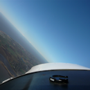
[img]https://ibb.co/s68Pssp[/img]
Quick and dirty botch in GE
[img]https://ibb.co/YPPTbsS[/img]
[img]https://ibb.co/xJTb2sB[/img]
Kent County Council has (or had...it's a long time since I looked) an HER viewer online which has some of the late 1940s and early 1960s photographic survey on it (they supplied imagery to google)
(these surveys were done over the whole country and local libraries /archives usually have copies)
For OS maps you want the late 60's 1:2500 for inclusion of the airfield detail.
The best way to do it is probably to get a scan of an RSP (the only one I know of is from 1956) and then overlay that onto current aerial photography in google earth. Also add the 1960s 1:2500 and then you can mess about to your hearts content with those plus 1940s, 1960s, 1990s and 2000 onwards aerial imagery better than my dirty botch example above
Who is online
Users browsing this forum: No registered users and 16 guests